
Urban Land Navigation During an Emergency
Have you ever considered what happens to transportation and navigation in a worst-case scenario type of emergency? Whether it’s a major earthquake, EMP attack, hurricane, or a host of other life-threatening situations, it’s very possible that you will no longer have access to internet or electronics – which means no more GPS or online maps to help you find your way around. You may not even be able to use your vehicle to traverse familiar streets, and everything can look different on foot.
So what do you do?
Here are 5 ways to help your Urban Land Navigation During an Emergency so that you can get to safety.
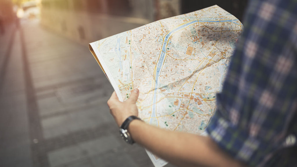
Paper Maps
No, we don’t mean GPS maps. We are talking hold-in-your-hand, electronic-free, old school, paper maps.
Many people have never had to use a paper map before, and it can be intimidating for new preppers or survivalists. If this is you, we suggest you pick up a few and familiarize yourself with them. The more familiar you become with maps of your area, the easier time you will have during a high-stress situation when you need to start moving fast.
Paper maps can show you various altitudes, routes, and let you plan accordingly for difficult areas of travel. We suggest having a street map of your city or town as well as a map for any surrounding areas. Keep these in your vehicle and in your go-bags. You might also consider a state highway map for a bigger picture of your area, and a topographical map to tell you about the local terrain.

Compass
For the best success with a map, you will need a compass. It isn’t always easy to know which direction you are facing, but a compass will (pun intended) point you in the right direction. You need to find North to properly orient yourself on a map.
A compass isn’t just useful with a map, however. If you don’t have a map of your area, being able to verify the cardinal directions (North, South, East, West) is still extremely helpful. A compass displays cardinal directions in a 360° format. North is 0°, East is 90°, South is 180°, and West is 270°.
Keep a compass in your vehicle and go-bag as well. If you can find a multi-tool with a compass attached, that can be a great space-saver.
RELATED READ: The Ten Steps of Survival
The Grid System
Most towns and cities are built on a type of grid system. Highways that end in an odd number usually go North/South as do Avenues (uptown/downtown). Even numbered highways run East/West as do Streets (crosstown).
Except for large cross-streets that run in both directions, even-numbered streets run one-way towards the east and odd-numbered streets run one-way towards the west. Naming systems follow similar patterns (e.g., roads named after states typically run the same direction such as East/West).
So not only can you figure out your cardinal directions, if you are familiar with the area, you should be able to figure out where you need to go.

Celestial Navigation
If you find yourself stranded without map or compass to rely on, we have good news. People have been navigating the world without any fancy gadgetry for thousands of years. Using the sun and the North Star, you can at least get your bearings.
The sun rises in the East and sets in the West. So, during the day, noting the position of the sun can help you figure out your cardinal directions.
At night, finding the North Star will point you North. To find the North Star, simply find the Big Dipper constellation. Follow the two stars that form the outside barrier of the cup and extend that line pointing away from the mouth of the cup, and you will find the North Star.
Landmarks
Noting your surroundings is extremely important for survival, but it can also help you find your way.
Large bodies of water, tall buildings, or mountain peaks can give you an idea about where you are – as well as keep you from walking in circles.
Specific buildings also give you a lot of information depending on the area. In large, older cities for example, most churches were built facing East and can be used to get a rough estimate of the cardinal points of direction.
Be Prepared
The best way to navigate your areas is to be prepared. Familiarize yourself with your surrounding area. Don’t just let your map and compass sit around, gathering dust. Learn to use them so that when an emergency does strike, you feel confident in your ability to navigate through any emergency.
Check out The Survivalist's Guide to Not Getting Lost for tips on wilderness navigation.
Victor johnson
Great info,forgot how much I forgot. Thanks
Lorenzo D Lovato
Was helpful